Thinking about buying land around Mineral Point? The Driftless hills, karst bedrock, and historic mining give this corner of Iowa County a character that is beautiful and complex. Without the right checks, a great-looking parcel can hide buildability or financing hurdles that cost time and money. In this guide, you’ll learn what to verify before you write an offer, how land financing works, and the exact steps to take so you can move forward with confidence. Let’s dive in.
Understand the Driftless terrain
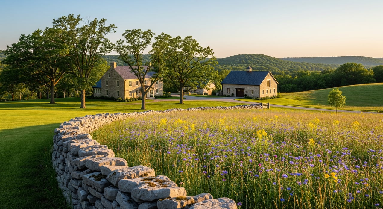
Hills, bedrock, and buildability
The Mineral Point area sits in Wisconsin’s Driftless Region. Expect rolling ridges, narrow valleys, and shallow bedrock. That topography affects where you can place a home, how you design a driveway, and whether your septic system will fit. Slopes and rock outcrops can raise earthwork needs and erosion risk, so plan for more site preparation than a flat suburban lot.
Historic mining and records
Mineral Point’s lead-mining past adds a layer of due diligence. Some areas in Iowa County have older mine workings below ground, which can impact stability and insurance. A careful review of historical records, deeds, and any mining-related easements is a smart early step.
Parcel patterns and who regulates
Outside the city limits you’ll find a mix of farms, rural subdivisions, and large-acreage tracts. Many parcels are governed by the county and local town rather than the city. Your path to permits depends on whether the land sits inside Mineral Point city limits, in a town, or as unincorporated county property, so confirm that early.
Check rules before you commit
Jurisdiction: city, town, or county
Identify the parcel’s municipal status before you fall in love with a plan. For unincorporated land, the county and the town usually control zoning, land division, driveway permits, and septic oversight. Inside the city, different rules apply. Confirm status with the Iowa County Register of Deeds or County Zoning and Planning.
Zoning and permitted uses
Zoning sets what you can do on the land, minimum lot sizes, and setbacks. Iowa County zoning, plus any town ordinances, will tell you if residential, agricultural, forestry, or commercial uses are allowed and whether you need a conditional use approval. Ask for the zoning classification and permitted uses upfront.
Land division and CSMs
If you plan to split a parcel or buy a newly divided lot, Wisconsin’s rural land divisions often use a Certified Survey Map. Counties and towns may limit how many lots can be created and require specific road frontage. Confirm whether a CSM or full plat is needed and what rules apply before you budget or design.
Covenants, easements, and road agreements
Many rural subdivisions have recorded covenants that guide home style, placement, or land uses. Utility and conservation easements, plus access easements, can shape where you build and who maintains private drives. Pull the chain-of-title from the Register of Deeds and review any covenants and road maintenance agreements in full.
Shoreland, floodplain, and wetlands
Shoreland rules, floodplain ordinances, and mapped wetlands can remove buildable area or require permits. Review FEMA flood maps and Wisconsin DNR wetland maps early. If the parcel shows wetland indicators or sits near a stream corridor, plan for a professional wetland delineation and setbacks.
Historic or conservation restrictions
Historic districts and conservation easements can limit subdivision, new construction, or tree removal. Ask the county planning department and local land trusts to confirm whether any recorded restrictions affect your parcel.
Confirm access, soils, septic, and water
Access and driveway permits
Verify legal access. Lenders and title insurers expect frontage on a public road or a recorded access easement. County and town highway departments issue driveway permits and set standards for culverts, sightlines, and winter maintenance. Get clarity on access and any private road obligations before you write an offer.
Soils, slopes, and karst
Soils determine septic suitability and how foundations will perform. The Driftless landscape has karst features, including fractured bedrock and sinkhole risk. That raises the stakes for groundwater protection and septic design. Use soil maps as a screen, then order a site-specific evaluation to understand your options for building and wastewater.
Septic (POWTS) permitting
Private Onsite Wastewater Treatment Systems are regulated statewide and administered by counties. Iowa County will require a site evaluation before issuing a building permit. Bedrock depth, high groundwater, and steep slopes can limit standard systems and influence the size and placement of your home site. Contact the county sanitarian to learn the process and any site constraints.
Wells and water supply
Most rural sites use drilled wells. In karst, well yield and water quality can vary by location. If an existing well is present, request recent water testing. If not, budget for drilling and yield testing with a licensed well driller. Unused wells must be abandoned according to state rules.
Utilities and broadband
Electric service availability and distance to power lines affect costs. Broadband access can vary in the Driftless region, though buildouts are improving. Contact local electric and communications providers early for service quotes and line-extension estimates, and check state broadband maps for coverage.
Flooding, wetlands, and environmental screening
Low-lying valleys and stream corridors can include floodplain and wetlands that limit development. In areas with a history of mining or heavy agriculture, consider environmental screening or a Phase I-style review. Ask the county about known contamination and review historical records as part of your diligence.
Financing, title, and taxes
Ways to finance land here
Raw land is harder to finance than a home on a lot. Common routes include:
- Land or lot loans from local banks or credit unions. Expect lower loan-to-value ratios and higher rates than a typical mortgage.
- Construction-to-permanent loans if you plan to build soon. You will need plans, a builder agreement, and a draw schedule.
- Farm and agricultural loans through Farm Credit or USDA Farm Service Agency if you have qualifying farm activity.
- USDA Rural Development home loans for eligible rural locations if you are financing a home and site together. USDA does not finance raw land alone.
- Seller financing or portfolio loans when conventional options do not fit.
What lenders expect
Lenders commonly ask for a recent boundary survey, septic and well information, a certified appraisal, and evidence of legal access. Start conversations with community banks, credit unions, and Farm Credit early so you understand down payment requirements and documentation for your specific parcel type.
Appraisal on rural land
Valuing unique acreage can be complex. Appraisers rely on recent comparable sales and the parcel’s highest and best use. Zoning limits, wetlands, easements, and access all influence value. If you have plans and bids for improvements, keep them organized for the appraisal and underwriting.
Title, surveys, and closing
Order title work as soon as your offer is accepted. Confirm recorded easements, mineral reservations, liens, and covenants that affect use or access. If boundaries or access are unclear, commission a boundary survey or ALTA/NSPS survey before closing. These steps protect you and satisfy most lenders.
Taxes and land programs
Property classification affects your annual tax bill. Wisconsin offers programs like use-value assessment for qualifying agricultural land and the Managed Forest Law for forested acreage. Ask the county treasurer or assessor about current classification, mill rates, and whether the parcel is in any tax program or subject to special assessments.
A step-by-step due diligence checklist
- Confirm jurisdiction and zoning with Iowa County Zoning and Planning.
- Pull recorded documents from the Register of Deeds. Look for covenants, easements, mineral reservations, and any mining records.
- Verify legal access, public road frontage, and any private road maintenance obligations.
- Request existing surveys. If none are available or boundaries are unclear, budget for a new boundary or ALTA survey.
- Contact the county sanitarian for septic feasibility and the county or town highway department for driveway permits.
- Schedule a professional soil evaluation. Consider a geotechnical review for slopes or shallow bedrock and assess karst risks.
- Review FEMA flood maps and DNR wetland maps. Order a wetland delineation if indicators are present.
- Test an existing well or budget for drilling and yield testing. Plan for required well abandonment if needed.
- Request quotes from electric and communications providers. Check state broadband maps for service options and line-extension costs.
- Explore financing with local lenders and Farm Credit or USDA where applicable. Confirm down payment, LTV, and documentation requirements.
- If you plan a split or future subdivision, verify CSM or plat requirements with county planning.
- Order any specialty inspections needed, such as environmental screening or historical mining reviews.
- Negotiate purchase contingencies that give you 30 to 90 days to complete these checks, depending on complexity.
Local resources to contact
- Iowa County Zoning and Planning Department for zoning, land division, and shoreland or floodplain guidance.
- Iowa County Register of Deeds for recorded covenants, easements, and chain-of-title.
- Iowa County Highway Department and your local town highway crew for driveway and access permits.
- Iowa County Health Department or Sanitarian for septic permitting and site evaluations.
- Wisconsin Department of Natural Resources for wetlands, well standards, and shoreland regulations.
- FEMA for Flood Insurance Rate Maps and floodplain status.
- USDA NRCS for soils maps and preliminary capability information.
- Local lenders, credit unions, and Farm Credit Services for land, construction, and agricultural financing.
- Local land trusts and the county historical society for conservation easements and historic mining records.
Make your Mineral Point land purchase smooth
Buying land in the Driftless takes patience and a plan. When you confirm jurisdiction, vet soils and access, and line up the right financing, you set yourself up for a successful build or long-term hold. If you want a partner who can coordinate surveys, permits, lenders, and negotiations while keeping your goals front and center, our team is here to help. Connect with Lovell & Co. to discuss a parcel you’re considering and map out a clear due-diligence path.
FAQs
Can you finance raw land near Mineral Point?
- Yes, but terms are usually less favorable than a home mortgage. Consider land or construction-to-permanent loans, USDA options when building a home, Farm Credit for qualifying ag uses, or seller financing.
How does karst bedrock affect septic and wells?
- Karst raises the risk of groundwater contamination and can limit conventional septic options. Plan for a site-specific evaluation and possible alternative septic designs, and test well yield and water quality.
Do you really need a survey on acreage?
- If you plan to build or finance, expect a lender to require a recent survey. If boundaries or access are unclear, a boundary or ALTA survey before closing protects you and prevents disputes.
Are wetlands common around 53565?
- Wetlands can occur along valley floors and stream corridors. They reduce buildable area and often require permits for impacts, so check maps and consider a delineation.
How long should you allow for due diligence on land?
- Budget 30 to 90 days, depending on complexity. Parcels with septic, wetland, or access questions may need the longer end of that range.
Who should you call for local guidance first?
- Start with Iowa County Zoning and Planning, the Register of Deeds, the county sanitarian, and local lenders. Add DNR, FEMA, and NRCS resources as needed, plus surveyors and engineers for site studies.